Showing posts with label landscapes. Show all posts

Tuesday, December 13, 2016

Patagonia from the Air

I was just chugging along in my Santa Cruz trek in Huaraz region of Peru when I overhead the guy behind me mentioned about flying from Punta Arenas to Santiago. He was saying something along the lines about having the most amazing view of Mt Fitz Roy in Patagonia. This jolted me alert as I had been contemplating flying down to the Patagonia region due to my limited schedule, but somehow had never thought about the ability to see the famed mountain from the air. I spoke to him briefly, and before I know it, my heart was kinda set on the flight.

Of course, it was all down to the flight cost. I have been searching on and off and it was only in Cuenca Ecuador when I finally settled down to confirm my plan. Apparently in summer, there are flights from Santiago to Puerto Natales and I managed to find, on the Chilean LATAM airlines site, a flight from Santiago to Puerto Natales at US$87 all-in! Considering that this 3-hr flight saved me a few days of travel southwards, and likely money as well, as the long distance buses while comfortable, do add up, it was a done-deal. And of course, there are the views :).

The tip from my trekking friend Thomas was, on the northbound flight, seat on the right. So for me, I had to seat on the left. 23.5hrs to my flight, I login to the airlines website to check-in and select my seat, and to my horror, all the leftmost window seats are all taken! I had to settle for a middle seat and kept a tiny flicker of hope that I might still get a window seat somehow.

Well, the flight was quite full. So there I was, a fidgety figure frequently looking wistfully over to the window and trying to take pics. The lady at the window seat was very understanding though, but it was still rather inconvenient stretching across (her chest) to the window to take the pictures. But ironically when Fitz Roy came into view, I still did not recognize it and wondered briefly which beautiful mountain was that!

Cerro Fitz Roy and even Cerro Torre partially covered

Somehow, up to this duration of the flight, it did not occur to me that beside Mt Fitz Roy, there are more to Patagonia from the air... At some point, some guy at the front mentioned Perito Moreno, and an internal lightbulb connected. I was almost standing up, craning my neck to its limits but alas, the clouds seemed to have thickened quite abit further south and I could not even catch a glimpse of it, or even what I am seeing. I can only cross my fingers and my toes and take whatever pics I can. When the plane flew over the Towers of Paine, the clouds eased up a little just to tease me with a glimpse of where the Towers are. It was a little disappointing.

Torres del Paine covered

Torres del Paine covered

Nevertheless, I'm really still quite happy to see the landscapes of Patagonia from up in the air. While I have seen the famous landmarks of Patagonia on land (Cerro Fitz Roy & Torre, Perito Moreno glacier, Torres del Paine), it would be cool to be able to see all of them in the air in one flight. And that commercial flight path just allowed that. The notorious weather of Patagonia had allowed me to see one and I guess I should be contented.

For those who's doing the Patagonia route should consider this flight. Aside from Santiago, you could also fly from/to Puerto Montt as I believe the flight route down to Punta Arenas or Puerto Natales should be the same. Aside from LATAM, Sky Airlines fly some of these routes too and they have affordable fares if booked in advance! And remember, for southbound, get the window seat on the left. For northbound, get window seat on the right. And hope for good weather (less clouds)!

In the meantime, enjoy the views below! :)

Look at the colours of the lakes!!


That's a glacier I believe!


Can see its a glacier but doesn't look like its Perito Moreno

Sunday, June 28, 2015

Val d'Orcia & Pienza

The landscape in Tuscany is well-known, and many breathtaking images had been made there. Aside from the famous Chianti region, famed for its wine, there are other areas with equally enchanting landscapes. In particular, I am somewhat enamored with Val d'Orcia.

Val d'Orcia is added into UNESCO's World Hertiage Site list only in 2004. According to wikipedia, one of the criterions is :
"The Val d’Orcia is an exceptional reflection of the way the landscape was re-written in Renaissance times to reflect the ideals of good governance and to create aesthetically pleasing pictures."


I am absolutely won over by the "aethestically pleasing pictures" part. Indeed, with the rolling hills, the varied shaded fields, and well placed trees, the light play during the early morning and late evening hours is truly mesmerizing. The light and shadows on display create endless possibilities for a stunning image. A landscape photographers' dream scene.


Tuscany is a region that is best experienced with a vehicle. Public transport is limited to buses with limited schedules and only certain towns are linked by trains. However, it is still possible to appreciate Val d'Orcia on public transport and come away with its beautiful landscape pictures. One of the possible village/town to stay is Pienza, which has bus connections with Siena. The town itself was declared a UNESCO site even earlier, and perched on a hill overlooking the valley, it is an excellent site for photographing the landscape right within the town itself!

Pienza, a beautiful old town with beautiful views

Pienza is also situated between Montalcino and Montelpuchiano, both famous wine town/regions. Hence Pienza benefits from their success as well. Good selection of the Brunello Montalcino and the Nobile Montelpuchiano (both very highly regarded wines) are available everywhere, and it is a good life staying here with different wines for each of your meals. Pienza itself is also famous for its pecorino, a kind of Italian sheep cheese. Thus a stay in Pienza entails enjoying Italian food with great wine, sampling pecorino with great wine, and photographing stunning landscapes with great wine. What is there not to like about Pienza? :)

Check out Pienza and Val d'Orcia when you next visit Tuscany!

Friday, May 15, 2015

Driving through the Lofoten in Winter

It is not often that I have a driving road-trip with friends, and it was by a stroke of luck that I had managed to get two friends to join me on a short part of my Norway trip - the Lofoten islands.

The Lofoten is an archipelago well beyond north of the Arctic Circle, and is famed for its natural beauty of mountains, seas, bays and islets. In summer, it is popular for hiking as well as boat trips and water-based activities. In winter, things die down quite a bit though, with alot of tourist facilities closing or operating at very limited hours. However, it is a wonderful location for Aurora hunting. In addition, the winter scenery is just phenomenally spectacular. and so appreciating it on your own terms in your own transport is probably the best bet.

The easiest and fastest way to the Lofoten is flying into Svolvaer, the administrative centre for most of the Lofoten. My friends flew in (from Oslo) and by their accounts, the flight in was absolutely beautiful. I flew from Oslo to Narvik (on mainland Norway) instead, on Norwegian, a low-cost airline, and then took a bus in. The bus journey to Svolvaer to meet my friends had me glued to the window already. For those who prefer to do overland travel from Oslo, you can take the train from Oslo to Bodo, and then take a ferry. Finally, if you find yourself in Kiruna Sweden, getting to Lofoten is also easy. Get onto the Arctic Circle Train, and then bus in. You'll be spell-bound on all segments of your journey!

Bussing in the Lofoten in winter

We rented a car in Svolvaer, and then drove around the islands. It was arguably one of the most beautiful drive trips I had. If you ever have the opportunity, and love winterscapes, do check it out. In the meantime, enjoy a timelapse snippet of our drive through Lofoten in winter! (Remember to maximise the youtube screen :) )


Sunday, January 25, 2015

Dallol & the Danakil Depression

After visiting Erta Ale, the next highlight of the Danakil Depression is equally surreal, and no less easy to visit - the salt mines and sulphur springs of Dallol.

This time, our base is the "village" of Hamed Ila that consists of more of the rickety "tree-branch" huts that is common in the Afar region. Like the night in Erta Ale, sleeping options were just "safari beds" - outdoor collapsible camping beds, which was laid out outside the hut. It would be much cooler to sleep in the open.

The Afar homestead, and the only accommodation option (though we slept outside)

Again, military escorts were brought in, and the visit to the sulphur springs was first. This time, we were driven barely an hour and then it was "only" a 30-40 minutes walk to the site. But it was a walk through a broken land of sharp rocks, bizarre-shaped formations, and soul-sapping heat. I had brought a 1-litre bottle of water along and it was barely enough.

The yellow-brown-stained landscape is an eye-opening sight. I had thought the Bolivian Altiplano desert to be unearthly but the scene here is downright alien. Bubbling pools of  yellow-white sulphuric acid smear the reddish-brown hardened ground, with pockets of greenish mineral ponds and ghastly weird protrusions scattered throughout. Admiration of the scene though, was somewhat marred by the suffocating sulphuric air (even with a face mask) and the constant heat. So remember to bring a good face mask and plenty of water! I was on the verge of a heat-stroke on return to our vehicle!

Military escort vehicle leading us through broken and used land - this used to be covered with salt!!

Short hike to the sulphur springs

Alien landscape

Alien landscape
Sulphur deposits and acid pool

The visit to the open-plain salt mine is relatively "straitforward", as compared to the other sites. The depression was created as a result of tectonic plate movements, and as a result, seawater flooded the depression many years ago. When the seawater dried up, a layer of salt encrusted the entire ground. When we reached the "mining site", it was in the middle of nowhere, and there was nothing but some waiting camels and a group of Afar men hacking, cracking and prying salt blocks from the ground using primitive tools. There was absolutely no sign of any permanent structure or machine, and when enough salt is harvested, the salt merchant would then transport the salt out using their camel caravans. I could never imagine how they could work under such conditions with barely a shelter in sight!

Breaking the salt ground and prying out the salt

Blocks of salt would be cut into standard size and loaded onto the camels

As mentioned in the previous post, most trips to the Danakil Depression start from Mekele in northern Ethiopia, and include both Dallol and Erta Ale. Trips can be arranged in Addis Ababa and while overland trip is possible, you will need 2 more days to-and-fro from Addis. Flights to Mekele will make sense if your international flight to Ethiopia is on Ethiopian Airlines as you would get very competition prices for their domestic legs. So check out the prices before you decide.

The sights in the Danakil Depression are indeed extraordinary, and for those who are willing to face the hardship, they would be rewarded with a very memorable trip, though probably in more ways than one!

Salt merchants transporting salt in their camel caravans
-120m below sea level and 45 degrees Celsius

Sunday, June 30, 2013

Cappadocia Turkey

Outside of Istanbul, Cappadocia is probably the next best known and popular tourist attraction in Turkey. And it's not hard to see why.

Cappadocia light and landscape

Famed for its geological features, visitors would be treated to a variety of sights rarely seen elsewhere. Rock-hewn houses, cave churches, underground dwellings, and bizarre-shaped rock formations scattered over a moonscape - there are definitely enough things to impress most people. To further add to the tourists' favorable impressions, accommodation options include 'cave hotels', where you stay in actual cave rooms natural to this region. And these cave rooms can cater to all budgets. From beautifully furnished and decorated hotel rooms to hostel dormitory rooms!!

Visitors queuing to take a peek into the cave houses in Goreme Open Air Museum
A hotel built inside one of the phallic-shaped stone formations
Ancient frescoes inside one of the cave churches

There are a couple of towns within the Cappadocia region, though Goreme seems to be the favourite for backpackers. Being close to the Goreme Open Air Museum, and hiking trails certainly helps. Hiking through Rose Valley, Pigeon Valley, or visiting the Uçhisar Castle in Uçhisar - these are all common itinerary for most visitors. And photographic wise, the lighting and opportunities are all to die for. But one of the best experiences though, both in terms of travel as well as photography wise, would be to take a hot-air balloon flight!

There are quite a number of hot-air balloon companies in Cappadocia and most agencies can arrange flights with them. However, there seems to be some syndicate operation going on, as there had been reports of tourists signing up flights with a specific company but ended up with other companies instead. So ask and verify carefully. Flights last about an hour, and you get to witness sunrise over the surreal landscape in a hot-air balloon. Spectacular!! It's hard not to come away impressed.

Imagine flying higher than the sun...! ;)

Floating above the surreal landscapes of Cappadocia
On a typical morning, hot-air balloons fill the skies of Cappadocia

So if you are thinking of doing a hot-air balloon once in your life somewhere, Cappadocia is a good bet!

Sunday, June 14, 2009

Canadian Rockies

I visited the Canadian Rockies many years ago, but it remains one of my most memorable trips. Aside from the absolute beauty of the place, there were a couple of "first" for me, and its these that make trips extra memorable.


The Canadian Rockies cover a large part land, and not just cover Alberta, but parts of British Columbia as well. It covers a number of national parks, the most well-known and/or popular being Banff National Park, and Jasper National Park. The best way to really enjoy all these really, is to have a leisurely drive trip. Not just for photography reasons, as the tour buses just let you stop at certain viewpoints for a short time, and you will not be able to fully experience the true beauty of the park.

There are rugged mountains and pristine lakes. There are ancient glaciers and raging rivers. And within these beautiful landscapes, the wildlife is equally jaw-dropping. All these have to be experienced and appreciated with time, and the best way is to trek/walk around the parks. Day treks are plenty, and if you have the appetite for more, longer treks are possible. The best part is, the park information centres provide excellent resources and info, so it's definitely a must-do for a visit to these rockies.


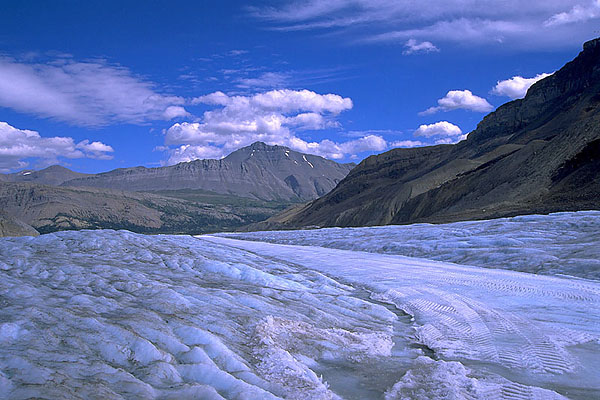
This was my first trip with an SLR. I used slide film for the first time! First time I stepped onto a glacier. I had my first "seizure" somewhere near some mountaintop. And it was my first time seeing wildlife like bighorn sheep, elks and most wondrously, a black bear! Certainly good reasons to be one of my most memorable trips ever!
But if you are a nature lover, enjoys the outdoors, an animal fan etc, this could easily be your memorable trip as well. Go experience the Canadian Rockies!

Saturday, June 6, 2009

Transylvania

Transylvania often conjures up dark and sinister images, as its name is made famous by Dracula, a novel by Bram Stoker, and countless film depictations.


But see the Transylvanian landscapes in better light (literally!), and you'll be amazed at its beauty. I am fortunate to visit Transylvania during autumn, and the autumn foliage certainly enhances its beauty! If possible, drive through the countryside, and stop to admire, or even have a picnic.
Forget Dracula. Enjoy Transylvania.


Sunday, August 10, 2008

Northern Pakistan

When we read about Pakistan in the news, they are mostly on war, disasters and generally depressing and negative news. Which is such a waste, cos the country is such a wonderful travel destination. It's landscapes and sceneries are just fantastic, and with 8 of the 13 mountain peaks above 8000m in Pakistan, it is a mountaineer's dream destination.


But one of the most amazing things I experienced in Pakistan besides the landscapes, are the people. They are among the friendliest people I meet in my travels, and their hospitality is what makes travel in Pakistan one of the most memorable as well. I got invited for teas, and even joined a family for dinner in their house and they would go all out to make you comfortable. And we just met on the streets.


I flew into Lahore, and covered mostly Northern Pakistan, so I actually have no experience in travel in the southern part of the country. However, from what I gather, I do feel the northern part provides the best experience and photo opportunities in both landscapes as well as people and culture. Moreover, the Karakoram Highway is in any backpackers dream trip, and that alone could warrant you a trip to Northern Pakistan!