Sunday, July 29, 2012

Sümela Monastery, Turkey

For those who had ventured to the eastern part of Turkey, or specifically, for those who found themselves in Trabzon on the Black Sea coast of northeastern Turkey, Sümela Monastery is simply one of the must-visit attractions there!


Also known as The Monastery of Virgin Mary, it was a Greek Orthodox monastery built into the face of a steep cliff. Founded by 2 hermit priests who discovered a miraculous icon of the Virgin Mary in a cave in the mountain, the monastery had gone through various restorations in its long history. However, in recent times, it looks like the monastery could do with some preservation, especially the amazing frescoes found in the monastery!!

Indeed, the frescoes on the walls and ceilings of the various buildings in the monastery are one of the best I've seen! Unfortunately, poor protection of the site had resulted in most of the frescoes being damaged by wandering shepherds and ignorant tourists. However, there are reports that in 2012, the Turkish government would be funding some restoration works, and it would bode well for the local tourism.  Sümela Monastery is currently in the tentative list of UNESCO sites for Turkey.


There are many agencies and hotels in Trabzon arranging day tours to the monastery, which is basically just shared van transport to the monastery. You can, of course, pay for private tours and guides. You'll be deposited near the entrance of the monastery, and after approximately 1.5 hrs, you can take a short walk down a path back to the carpark where the van would bring you back to Trabzon.

Hopefully, the restoration works would enable the site to revert back to its full glory!! Check it out once you have the chance!

Sunday, July 22, 2012

Alamut Valley

One of my favourite places I visited during my trip in Iran is the trip to Alamut Valley. Famed for some great scenery, trekking opportunities and a famous castle ruin, backpackers and guidebooks gave really positive feedback for the place.


However, I went when the season was plunging into winter (Nov), and the night before, there was a heavy snowfall that blocked parts of the road such that I almost could not make the journey. So, I didn't have any trekking opportunities, but the resulting white landscapes more than made up for it! The whole journey as we entered the valley had us glued to the car window, and forcing our driver to make a couple of photography stops. And the amazement did not stop as we reach the village of Gazor Khan, our entry to Alamut Castle.


Perched on a steep cliff, Alamut Castle is one of the famed Castles of Assassins. This castle, led by Hassan-i Sabbah, is a stronghold of a Ismaili Muslim group. Part of this group, The Assassins, target high level figures and many stories of their history and origins etc can be found on the Net. As romantic as the history may sound, the hike up the snowy paths and stairs were alot more down-to-earth. Reaching the entrance, a soldier-cum-guard would register our presence, and then escorted us into the castle ruins. The ruins itself, though, were just stones and corrugated metal sheetings. But it's the commanding views that catches our breath away, and possibly explained why Alamut roughly means “Eagle’s Nest”! The view of the entire Alamut valley, with pretty Gazor Khan below all covered in a beautiful white coat was simply phenomenal! Truly one of the best landscapes I've seen in a while!

Alamut can be reached via shared taxis from Qazvin, a city north of Tehran. I managed to meet up with 3 other travelers in Qazvin, and shared taxis can be arranged from the hotel. From Gazor Khan, shared taxis back to Qazvin leaves early mornings 5-6am. There are a couple of homestays in Gazor Khan (as listed in Lonely Planet guide), and it's definitely recommended to stay a night or two if you're intending to trek/hike (where weather permits).

For me, the views atop Alamut Castle would stay foreever etched in my mind....


Sunday, July 15, 2012

Stolby Nature Reserve, Krasnoyarsk

For travellers planning their Trans-Siberian journey, here's a tip. Besides your obligatory stop at Lake Baikal, do check out Krasnoyarsk. Or more pointedly,  check out Stolby Nature Reserve, especially if you're doing it in autumn!


The Stolby Nature Reserve is set in a taiga forest, and amidst this forest, rock cliffs of various shapes and sizes rise up majestically. These rocks are called 'stolby' and hence its name. 'Stolby' is actually the plural for 'stolb' which is Russian for 'pillar'. Naturally, some of the more uniquely shaped or prominent rocks would have names bestowed upon them, like 'Grandmother', 'Grandfather' etc.


Aside from hikes and walks, many of the locals also come here for another sporting activity - rock climbing! In fact, it is a very popular spot for 'free climbing', both for leisure as well as for training! I was lucky that I befriended some Russians who guided and helped me with some climbing. And atop some of the high stolby, the views are just spectacular! In summer, the expanse would be undoubtedly a sea of green (which can be nice), but in autumn, the ocean of yellow, splashed with pockets of green is one of the more impressive autumn scenes I've seen! And I would love to witness what it's like in winter!!

The nature reserve can be reached via public bus number 50 from Krasnoyarsk city (but do confirm again as bus number routes can easily change). There is also a ski resort area easily accessible by bus (no. 37), but I hear that the stolby there are limited. So I highly recommend a visit to the Stolby Nature Reserve as one of your stops on the Trans-Siberian rail!


Monday, July 9, 2012

Street Art :: Graffiti

For someone who can't draw, or paint or even sketch, I have thus always admired the beautiful street art or even graffiti art in the streets of some of the countries I've been. And huge hand-drawn murals on the walls of buildings would always make me pause and gawk.

As it turns out, when I visited the vibrant city of Rio de Janeiro in Brazil, it was not the famous beaches, nor the carnival atmosphere that left the most impression. It was the impressive street art that decorate every drawable space on the streets!

So when you next visit Rio de Janeiro, try to walk the streets and admire these art. In any case, here's sharing some pictures of the street handiwork. Enjoy!


Sunday, June 17, 2012

Salento

For those travelers who love to chill in quiet little towns, check out one of my favourites in Colombia - Salento.


Situated in Colombia's La Zona Cafetera, a coffee growing region, Salento is actually a very popular tourist town. However, as it is very popular for local tourists, the "crowds" mainly come in during the weekends (and public holidays). Nevertheless, the town retains its laidback charm, and nestled in a plateau giving beautiful views over the surrounding valleys, as well as access to the Cocora valley, it is a great place to stop and relax.

For me, aside from the laidback lifestyle, two main factors helped made this one of my favourite places. The climate as well as coffee! Salento is situated at an altitute of about 1900m above sea level and boasts an average annual temperature of 15 °C, so it is really pleasant to walk around to soak in the views. And you could get a wonderful cup of machine-pressed Colombian coffee for just 50cents! Not to mention value-for-money menu del dias (lunch/dinner sets) in town! Gotta love those local trucha (trout)!!


Aside from trips to the Cocora valley, tourists can easily walk from town to a mirador (viewpoint) that provides stupendous views of the surrounding valley. The town also have certain architecture typical of that region and shops selling locally made handicrafts. And of course, you can take tours to nearby coffee plantations!


So if you have the time in Colombia, do check out Salento!


Saturday, June 9, 2012

Huayna Picchu

While most people would be aquainted with Machu Picchu, less would be familiar with Huayna Picchu (also known as Wayna Picchu). But Huayna Picchu will, quite literally, bestow a different view of Machu Picchu to you!

Huayna Picchu is the mountain peak that towers over The Lost City of the Incas. It is that tallest peak as seen in the many iconic pictures of Machu Picchu (the big "nose" of the face, if you know what I mean). Access to Huayna Picchu is restricted to only 400 visitors per day, split into 2 batches of 200 each, on a first-come-first-serve basis. The climb up is narrow and steep, so I guess this is a good arrangement. 


So together with other visitors who wanted to climb Huayna Picchu and were afraid that we could not get within the allowed number, we were at the gates at the base of Machu Picchu way before it opened. The moment the gates opened (5.30am) it was a mad race up to the Machu Picchu entry gate (where the Huayna Picchu "ticket" is issued). This is to ensure that we would be there before the first bus from Aguas Calientes reaches! But apparently, from what I gather, advance reservation is possible together with the purchase of your Machu Picchu ticket! Anyway, it was an exhilirating (albeit tough) early morning exercise!

After the strenous climb just to get the Huayna Picchu entry ticket, the climb up Huayna Picchu itself can be done at your own pace of course. Not a walk in the park but definitely manageable. At the peak, you can also visit some caves and temples but the views are what I climb for! From the summit, you can see the entire Machu Picchu in its full glory (as well as the the zigzag road up from Aguas Calientes). The Incas built the city in the shape of the condor, and one could only see it from a high enough vantage point! Can you see it?


Also, supposedly, old Cusco was built in the shape of a puma, and Ollymtambo was built in the shape of a llama! I was at a high vantage point in Ollymtambo but could not quite make out the shape. I supposed these towns/cities are expanding living sites, so the old shape may not be there anymore. Or maybe, you would need an almost aerial view to see it. But make the effort, and from Huayna Picchu, you could still make out the condor that is Machu Picchu!

Saturday, June 2, 2012

Lares Trek

One of the highlights of a trip to Peru is undoubtedly Machu Picchu, and the classic way to reach this wonder is via the Inca Trail. However, as the Inca Trail requires special permits and a controlled number of trekkers are allowed on it, advanced reservations are often advised and this may hamper those who's travel itinerary are just planned out a day in advance......


However, there are a number of alternative treks that one could enjoy from Cusco to Machu Picchu. I took the Lares Trek, and really enjoyed it (except the last day). There are a few variants of this trek itself, and the last day of our 3-day trek variant was on a vehicular dirt road, which was not exactly the best of trekking experiences. Still, it was overall a good outing, especially the first 2 days, which were absolutely fabulous!

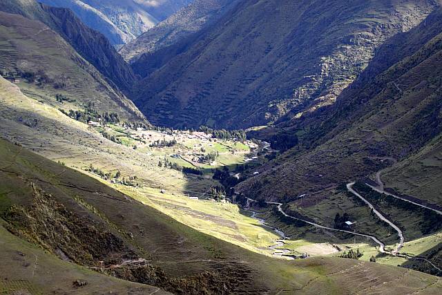
The highlight of the trek for me, is the campsite stop in the village of Huacahuasi. An Andean community still living in old stone thatched houses, complete with villagers donned in their colourful traditional attire, it was a good glimpse into a distant past. These villages are also known for their weaving, and so, getting a handwoven llicilas/manta/poncho would be a real deal vs getting something in the city of Cusco. And camping and sleeping under the blanket of the Milky Way is always something special. The trek itself was not exactly strenous although the altitude would slow you down, with the highest point being over 4000+m. Nevertheless, just take it slow, and stop and admire the beautiful Lares valley and its inhabitants!


The trek ends in the town of Ollantaytambo, where a train ride will bring you to Aguas Calientes where you would explore the wonderful Machu Picchu. A fitting end to a wonderful trek indeed!